Project overview
Where the project begins and ends, and the communities it serves.
The project extends from the New Jersey Turnpike / I-95 northbound ramp to Route 495 eastbound, through the Route 3 / Route 495 interchange, to the Route 495 / 30th Street exit. The work area lies within the Township of North Bergen and the Town of Secaucus in Hudson County.
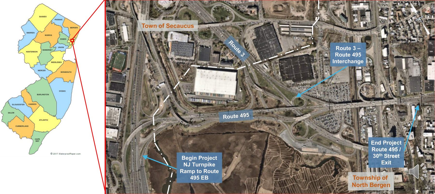
Figure — Project location map
Description of this figure
Aerial map showing the project limits along Routes 3 and 495: begin project at the NJ Turnpike ramp to Route 495 EB (southwest, in the Town of Secaucus), through the Route 3 – Route 495 interchange, to end project at the Route 495 / 30th Street exit (northeast, in the Township of North Bergen).
Purpose, needs & goals
Why this project is happening, and what it commits to.
Purpose
- Enhance safety and reduce delays at the Route 3 and Route 495 interchange
Needs
- Provide operational and safety improvements to interchange roadways and ramps
- Replace bridges
Goals
- Avoid, minimize, or mitigate impacts to right-of-way, utility, and the environment
- Remove left-hand exits and entrances
- Remove heavy weaving sections
- Maintain Exclusive Bus Lane (XBL) during all phases of construction
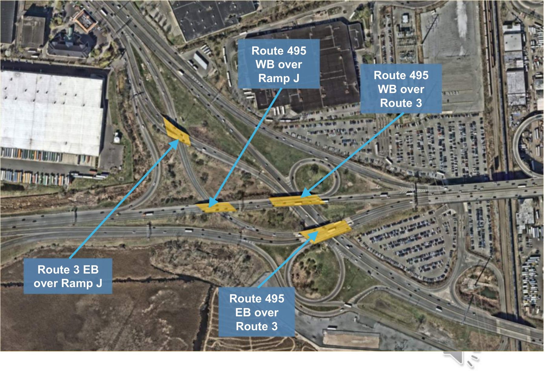
Figure — Bridges to be replaced
Description of this figure
Aerial view of the interchange marking the locations of four bridges, each highlighted and labelled: Route 495 WB over Ramp J, Route 495 WB over Route 3, Route 3 EB over Ramp J, and Route 495 EB over Route 3.
Existing conditions
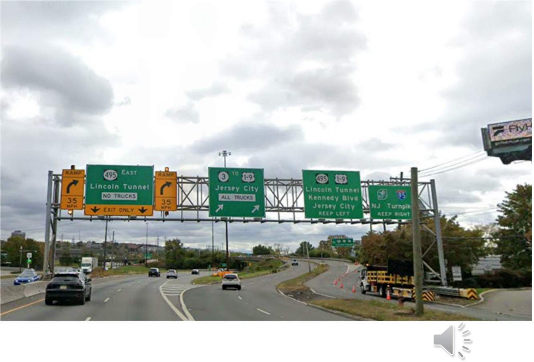
Both routes are urban principal arterial freeways posted at 50 MPH, carrying four to six lanes of divided traffic.
Route 3
- Urban Principal Arterial Freeway / Expressway
- Posted speed limit = 50 MPH
- 4–6 lane divided highway with median barrier
- Service roads both eastbound (South Service Road) and westbound (North Service Road)
Route 495
- Urban Principal Arterial Freeway / Expressway
- Posted speed limit = 50 MPH
- 4–6 lane divided highway with median barrier
- Westbound contraflow Exclusive Bus Lane (XBL)
Roadway geometry
- Substandard stopping sight distance on vertical and horizontal curves
- Substandard curve radii
- Substandard acceleration and deceleration lane widths
- Substandard inside and outside shoulder widths
Safety and operational issues
- Heavy weaving areas in the current interchange design
- Frequent occurrence of rear-end and sideswipe crashes
The Exclusive Bus Lane (XBL)
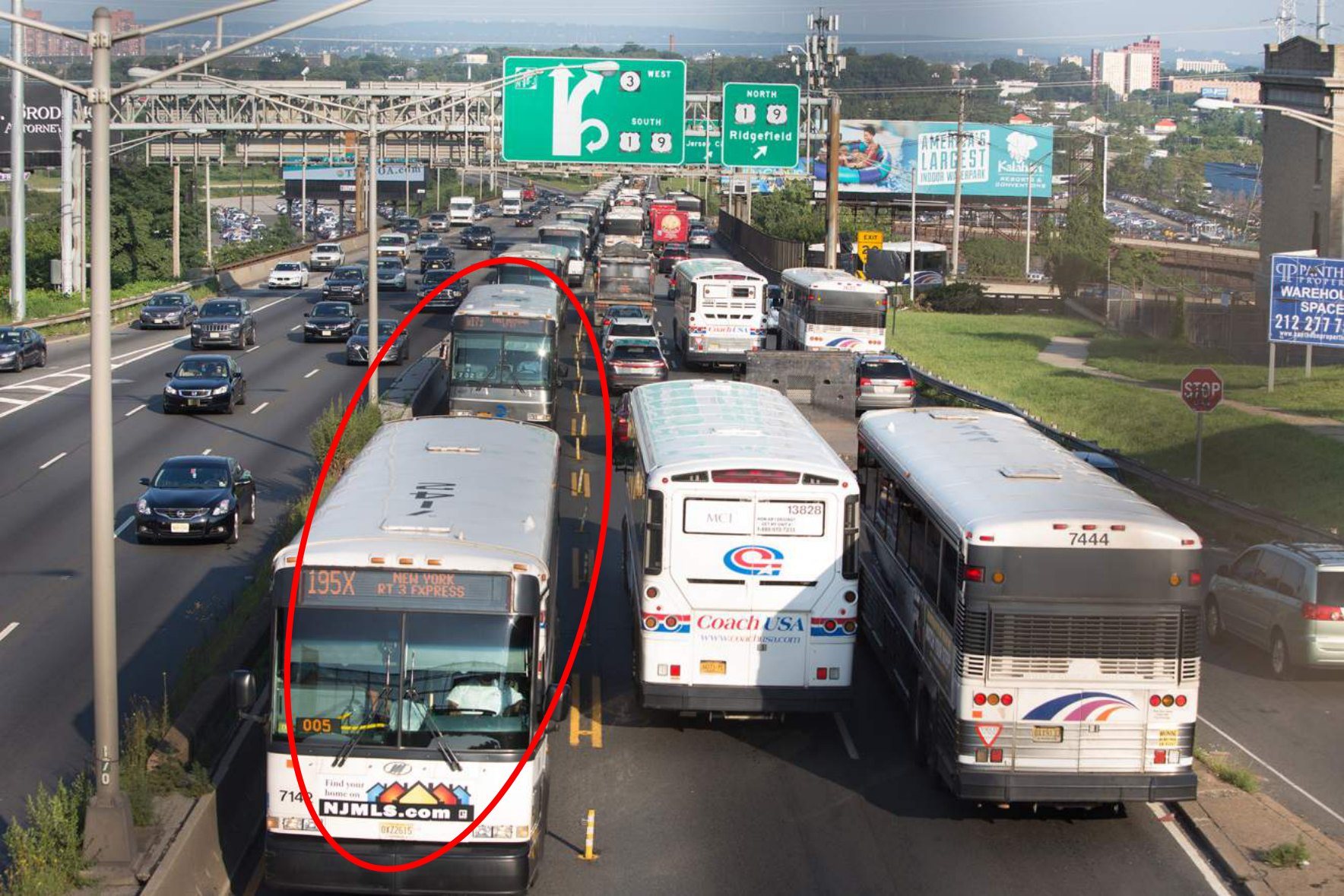
A 2.5-mile contraflow bus lane along Route 495 westbound, from the NJ Turnpike to the Lincoln Tunnel. It operates during weekday morning peak hours — approximately 6 a.m. to 10 a.m.
Proposed improvements
A reconfigured interchange: express and local lanes on Route 495 eastbound, Ramp D built over Ramp C, and Ramps A, B and H reconfigured.
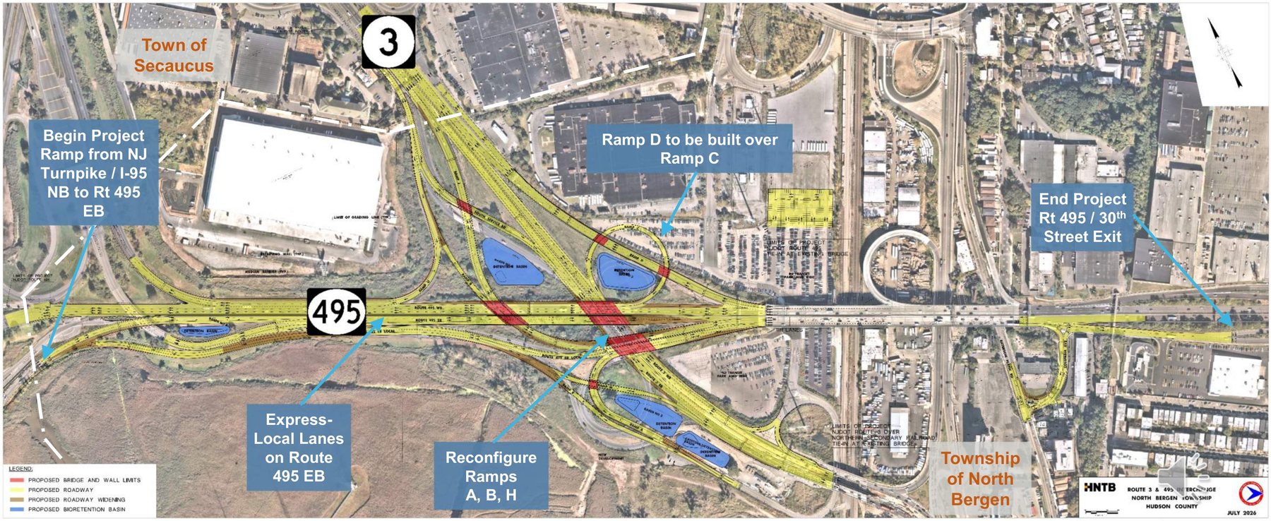
Figure — Proposed improvements: project plan
Description of this figure
Plan view of the full project, from the ramp from the NJ Turnpike / I-95 northbound to Route 495 eastbound (begin project) to the Route 495 / 30th Street exit (end project), spanning the Town of Secaucus and the Township of North Bergen. Callouts mark express–local lanes on Route 495 eastbound, Ramp D to be built over Ramp C, and the reconfiguration of Ramps A, B and H.
Ramps C & D
C: Route 3 WB → Route 495 WB · D: Route 495 WB → Route 3 WB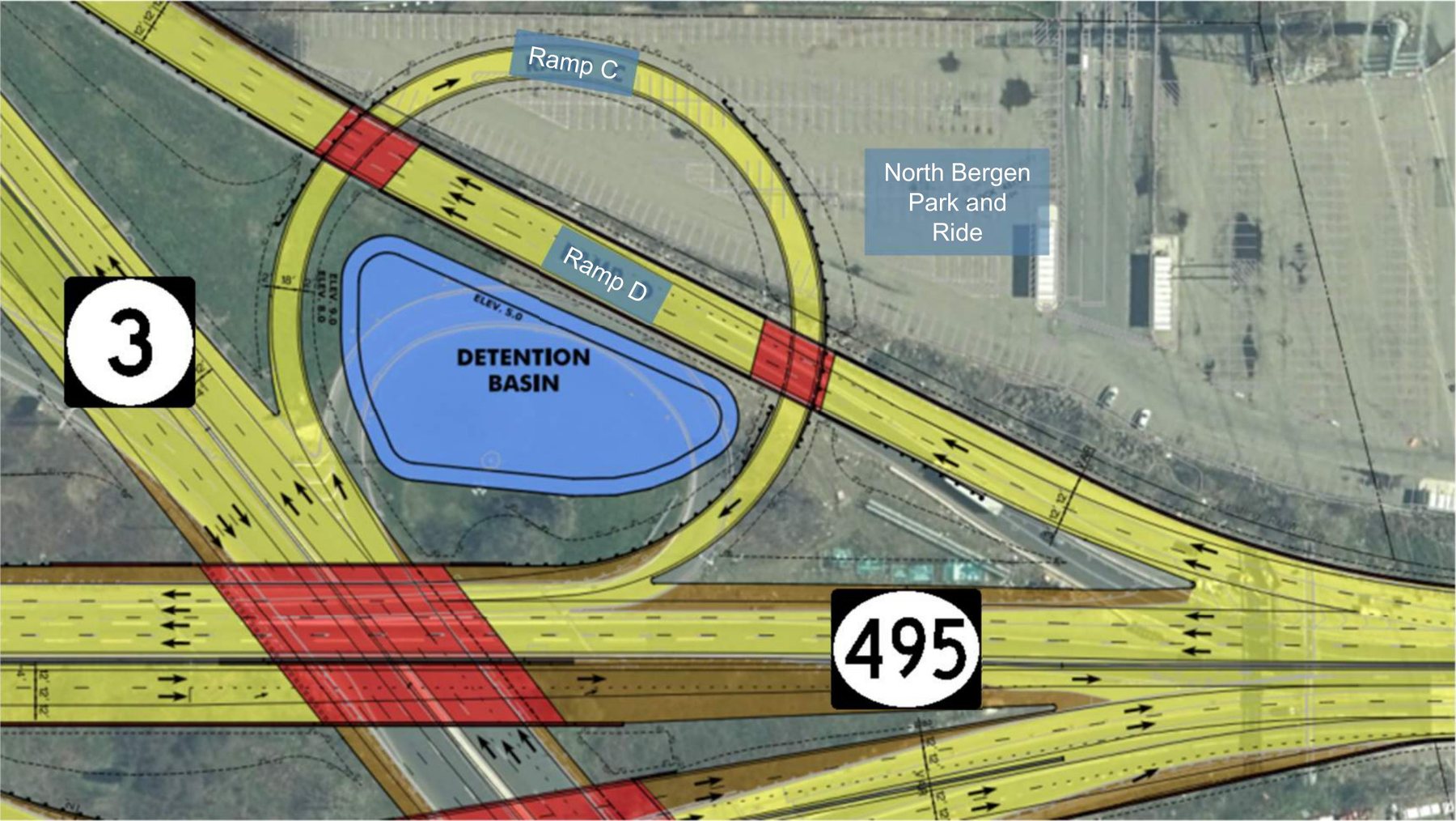
- Ramp D (Route 495 WB to Route 3 WB) to be built over Ramp C (Route 3 WB to Route 495 WB)
- Less fill needed to construct the interchange
- Less impacts to North Bergen Park & Ride
- Less visible profile
- Improved constructability
Ramps B & J
B: Route 3 EB → Route 495 Local EB · J: exit from Route 3 EB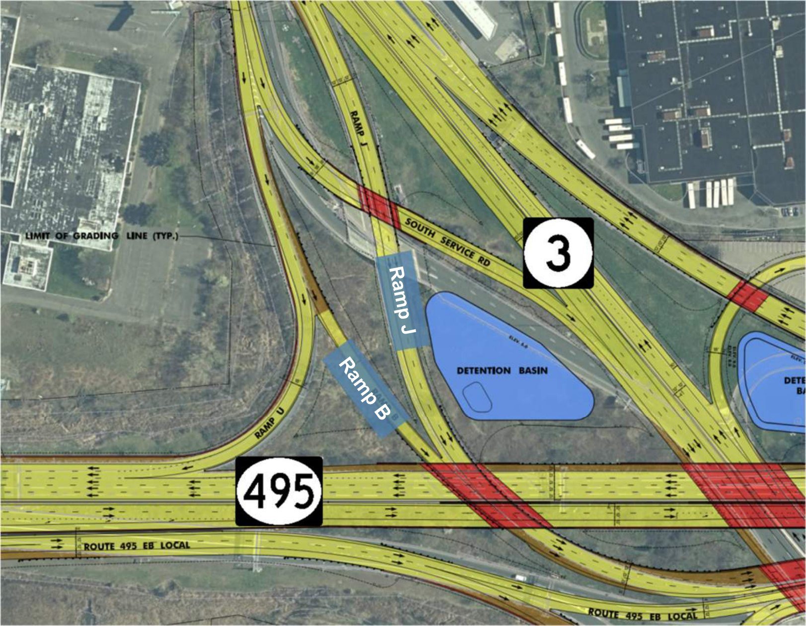
- Ramp J realigned as a right-hand exit from Route 3 EB
- Ramp B realigned adjacent to Ramp J
- Eliminates the heavy weave section between the South Service Road and Ramp B (Route 3 EB to Route 495 Local EB)
Ramps A & H
A: Route 3 WB → Route 495 Express EB · H: Route 495 Local EB → Route 3 EB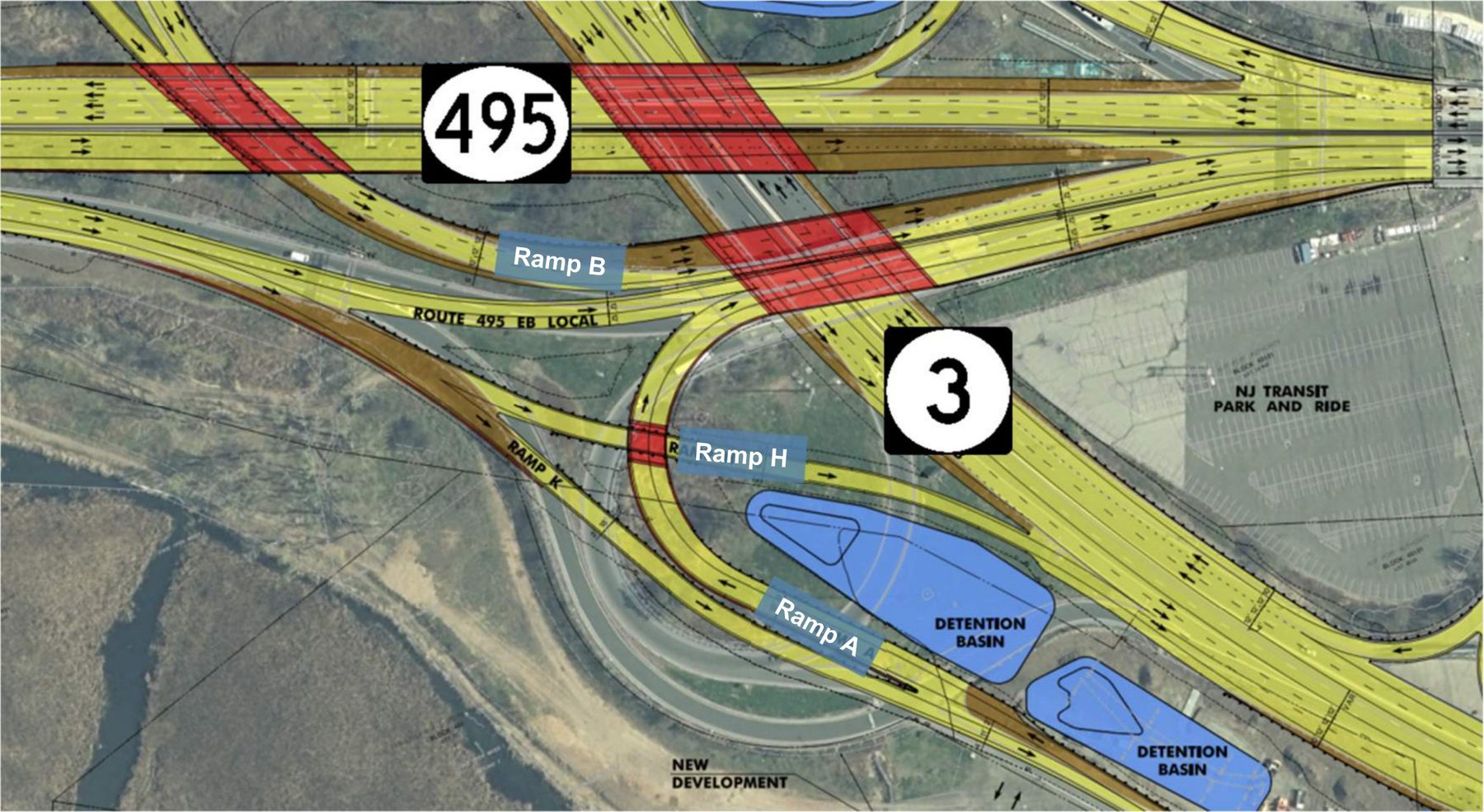
- Elimination of at-grade intersections along Ramp A (Route 3 WB to Route 495 Express EB): the at-grade intersection between Ramps A and H is removed, and the at-grade intersection between Ramps A and B is removed
- Ramp H (Route 495 Local EB to Route 3 EB) realigned to accommodate the Ramp A and Ramp B realignments
Environmental Resources & Impacts / Section 106
The project advances under the National Environmental Policy Act, with the following permits and consultations anticipated.
- National Environmental Policy Act of 1969
- USACE Nationwide Permit (NWP) 23
- Section 7 Endangered Species Consultation
- National Historic Preservation Act Section 106 Consultation
- NJDEP Flood Hazard Area Individual Permit
- NJDEP Hackensack Meadowlands Individual Water Quality Certificate
- NJDEP Stormwater Management Rules
- NJ SESC Plan Certification
- NJ Pollutant Discharge Elimination System (NJPDES) 5G3 – Construction Activity General Permit (GP)
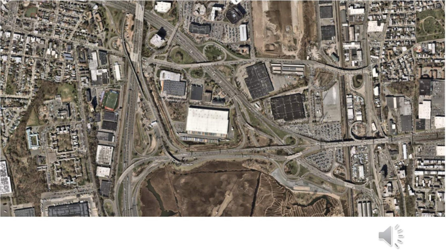
Figure — Environmental study area
Description of this figure
Aerial view of the Route 3 and Route 495 interchange and the surrounding developed and wetland areas that the environmental review and Section 106 consultation cover.
NJ Transit — North Bergen Park & Ride
Parking impacted by construction of Ramp C is replaced with new spaces.
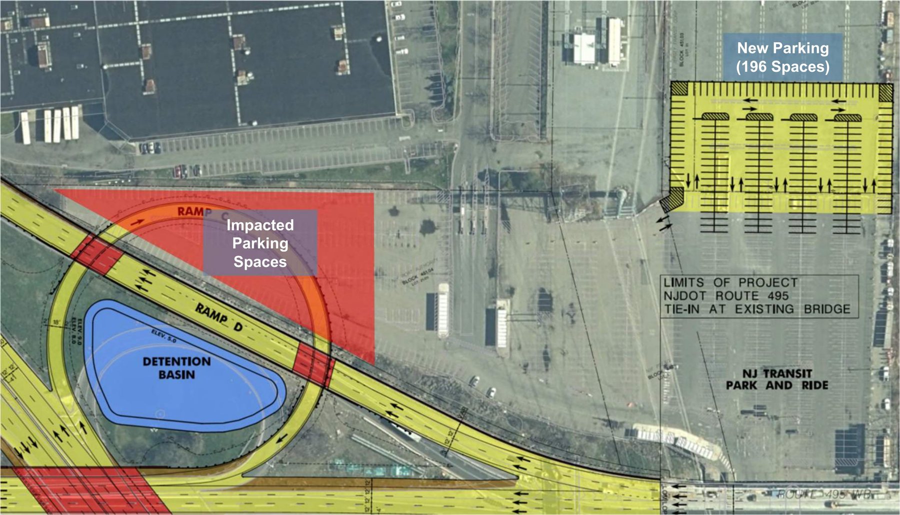
Figure — Park & Ride impact plan
Description of this figure
Plan of the North Bergen Park & Ride marking the parking spaces impacted by construction of Ramp C, and the new parking area of 196 spaces to be constructed.
Construction staging
Construction proceeds in a pre-stage plus five stages, keeping the Exclusive Bus Lane in service throughout.
PREPre-Stage 1
- Construct new parking at former bus lot
- Construct temporary Ramp D from Route 495 WB to Route 3 WB
1Stage 1
- Construct the two Ramp D bridges
- Construct first half of Route 495 bridges over Ramp J and Route 3
- Begin construction on the more direct access to Route 3
- Begin construction on Ramp B
- Move Ramp D to temporary alignment
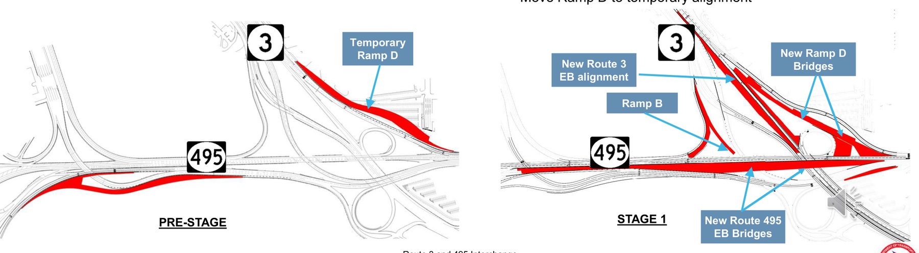
Figure — Construction staging: Pre-Stage and Stage 1
Description of this figure
Two plans of the interchange. The Pre-Stage plan highlights the temporary Ramp D alignment. The Stage 1 plan highlights the new Ramp D bridges, the new Route 495 eastbound bridges, Ramp B, and the new Route 3 eastbound alignment.
2Stage 2
- Construct second half of Route 495 bridges over Ramp J and Route 3
- Construct new Ramp C
- Complete construction on Ramp B
- Shift Route 495 WB traffic to the future WB bridge over Route 3 and Ramp J
3Stage 3
- Construct first half of the bridge carrying Ramp J, Ramp A, and Route 495 Local EB
- Shift Route 495 WB into permanent alignment
- Open Route 495 EB Express
- Shift Ramp J to the right, open new Ramp B
- Construct new Ramp A over Ramp H bridge offline
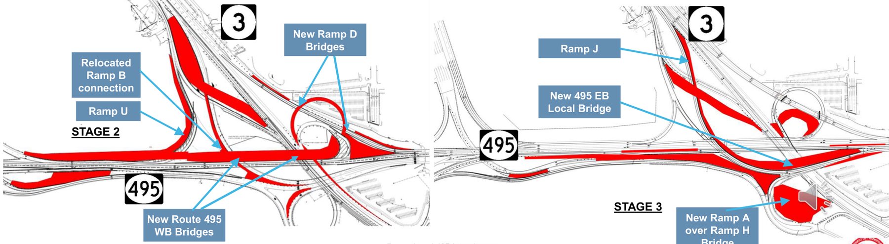
Figure — Construction staging: Stage 2 and Stage 3
Description of this figure
Two plans of the interchange. The Stage 2 plan highlights the new Route 495 westbound bridges, the new Ramp D bridges, Ramp U and the relocated Ramp B connection. The Stage 3 plan highlights Ramp J, the new Route 495 eastbound local bridge, and the new Ramp A over Ramp H bridge.
4Stage 4
- Construct second half of bridge carrying Ramp J, Ramp A, and Route 495 Local EB over Route 3
- Shift traffic on Ramp J, Ramp A, and Route 495 Local EB to the new bridge
5Stage 5
- Open temporary Ramp H alignment
- Construct permanent Ramp H and Ramp K alignments, shift traffic onto permanent alignments after construction completed
- Completion of Route 3 WB and Columbia Avenue construction
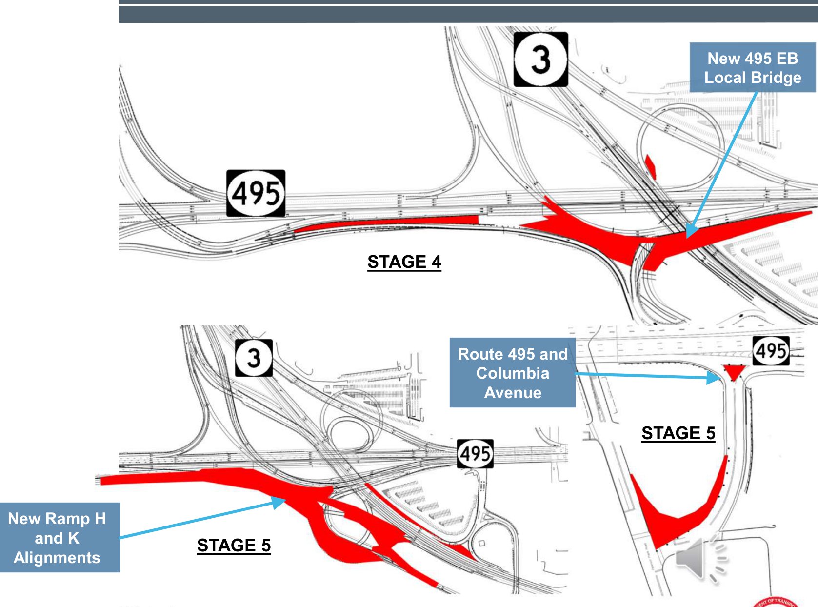
Figure — Construction staging: Stage 4 and Stage 5
Description of this figure
Two plans of the interchange. The Stage 4 plan highlights the new Route 495 eastbound local bridge. The Stage 5 plan highlights the new Ramp H and Ramp K alignments and the work at Route 495 and Columbia Avenue.
Estimated project schedule
Anticipated milestones from concept development through construction.
- April 2023 CD Report complete / PPA selected
- Spring 2024 Preliminary engineering initiated
- May 29, 2026 Local officials meeting
- September 2026 Public Information Center
- End of 2026 Submit CED — finalize preliminary design
- Spring 2027 Initiate final design
- Early 2029 Complete final design
- Fall 2029 Construction start
- End of 2033 Construction complete
Document center
Official project materials for review and download. Every document lists its type and size, and everything essential is also published as accessible text on this page.
-
Everything in this presentation is also available in accessible HTML on this page.
-
The flyer’s content — dates, how to take part, project background, staging, and schedule — is also on this page in accessible HTML.
-
Spanish-language version of the PIC notice. The same content is on the Spanish pages of this site in accessible HTML.
-
Overall proposed geometry for the interchange: proposed roadway, roadway widening, bridge and wall limits, and bioretention basins. It is a full-size display sheet (120 × 50 inches), so it is best opened on a desktop. The same layout is described in plain language in the Proposed improvements section of the Project Information page.
Questions or comments?
Questions or comments about the project can be submitted using the fields provided on this website, or submitted by mail or email to the project contact below.
Go to the comment formOffice of Government & Community Relations
New Jersey Department of Transportation
P.O. Box 600, Trenton, NJ 08625-0600
Phone: (609) 963-1982
Email: Patience.Sengbey@dot.nj.gov